Within an hour of finishing work on Tuesday, we packed, made a motel reservation, gathered trail guides and headed west on Route 12 to hike the Under the Point Trail which circles the base of Powell Point. We hiked about a mile and a half before billowing dark clouds and rumbles of thunder announced the threat of storms in the area. Lucky for us, this first part of the route is the most scenic and we were able to see Powell Point from the bottom. We've had views of Powell Plateau from various directions as well as the vista from its summit; this provided another, very different perspective.
 |
| Looking up to Powell Point |

On the way to Escalante several serious bolts of lightning flashed nearby making us glad we'd cut the hike short. Hoping for directions to locate the Hundred Hands Panel of pictographs (pictures or symbols painted on rock) at the Escalante River trailhead, we stopped at the visitor center. The ranger said they are not allowed to divulge any information because the panel is sacred to the Navajo. A borrowed trail book (thanks, Mike and Linda!) provided a few clues plus some trial-and-error led us to the panel. A bit further along the same cliff-face are petroglyphs (pictures or symbols incised into rock) that clealy illustrate why the Navajo do not want to expose their heritage to the public.
 |
| The Hundred Hands Panel (pictograph) |
 |
| The Hundred Hands Panel is the smooth tan rectangle above the oval cave in the center of this photo |
 |
| Petroglyph near Escalante River Trail Head |
 |
| Why the Navajo don't want the location of ancient artwork revealed. [Note petroglyphs destroyed by attempt to remove one section.] |
After the scramble up, along and down the cliff in late afternoon heat, the Powell Point hike and the morning's work, we were tired and hungry. The restaurant we selected for dinner was hopefully not Escalante's best. Even though the food was disappointing, the waitress was nice and the portions were large. But who wants lots of bad food?!
With afternoon thunderstorms forecast for Wednesday, we left early to hike 'The Box' in the Box-Death Hollow Wilderness. The trail is 8 miles one-way and requires a shuttle; without a second vehicle, we opted for an out-and-back of the lower section. Pine Creek, which carved the 800-1200' deep canyon, begins as spring on Boulder Mountain and becomes a main tributary of the upper Escalante River. It is generally 6-10' wide and usually shallow enough to rock-hop across. Thunderstorms the three previous days made the stream high and muddy and required wading to cross. We did that 15 times in each direction! The water felt frigid on first few crossings then refreshing as the sun rose higher.
 |
| One of 30 crossings |
In most places the canyon is wide and supports juniper, ponderosa, pinyon pine, shrubs and wildflowers; the slickrock walls and Navajo sandstone cliffs are a rainbow of buff, red, pink and white. The route basically parallels the creek but precisely where you walk is up to you and conditions at the time. Don't feel like scrambling up that cliff? Wade in the water. Creek blocked by debris? Detour via the bank which looks most promising.
We were enjoying ourselves so much that I wanted to suggest we do the entire trail but before I spoke, Fred pointed out dark clouds suddenly looming above the canyon walls. In southern Utah, mornings are usually safe with the chance of thunderstorms escalating in the afternoon. Storm clouds by 11 AM is ominous and only the foolish ignore their potential danger. We were back at the Jeep a few minutes past noon and, following a stop at Escalante Outfitters for drinks and their huge brownies, on the return to Tropic.
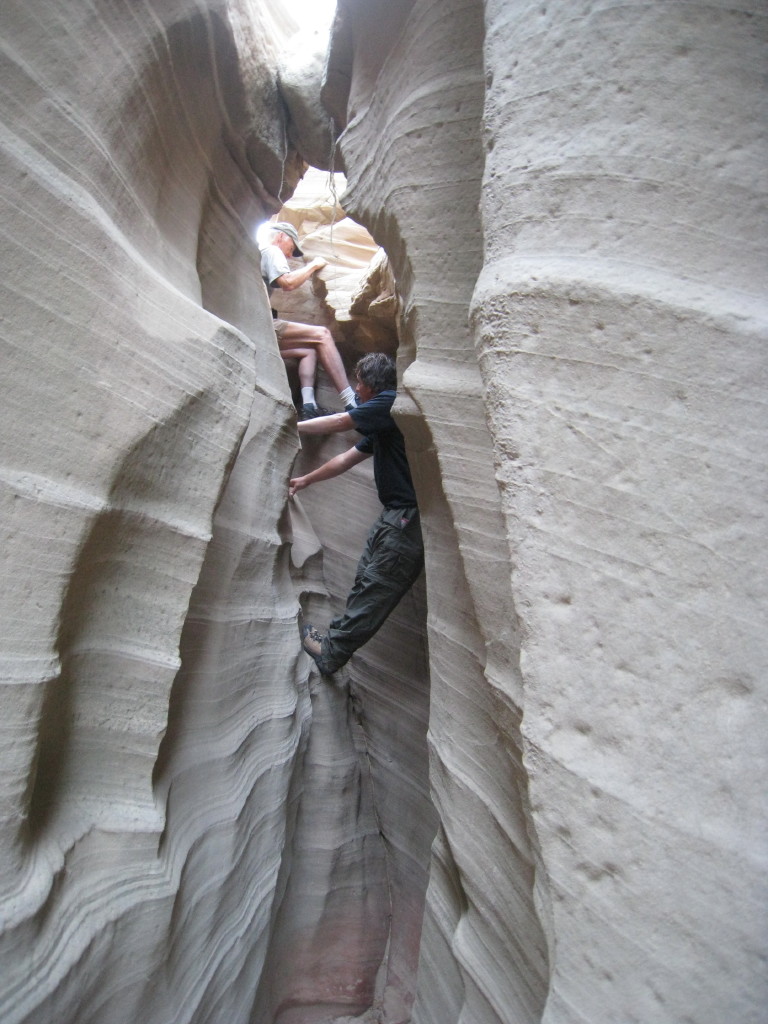
Thad, who is not Chad, but is, like Chad, the owners' son-in-law who works at the inn, offered to take us through Round Valley Draw this morning. We jumped at the opportunity because we'd heard it's an exceptionally beautiful, rarely visited slot canyon that requires some technical moves to descend/ascend the drop-offs.
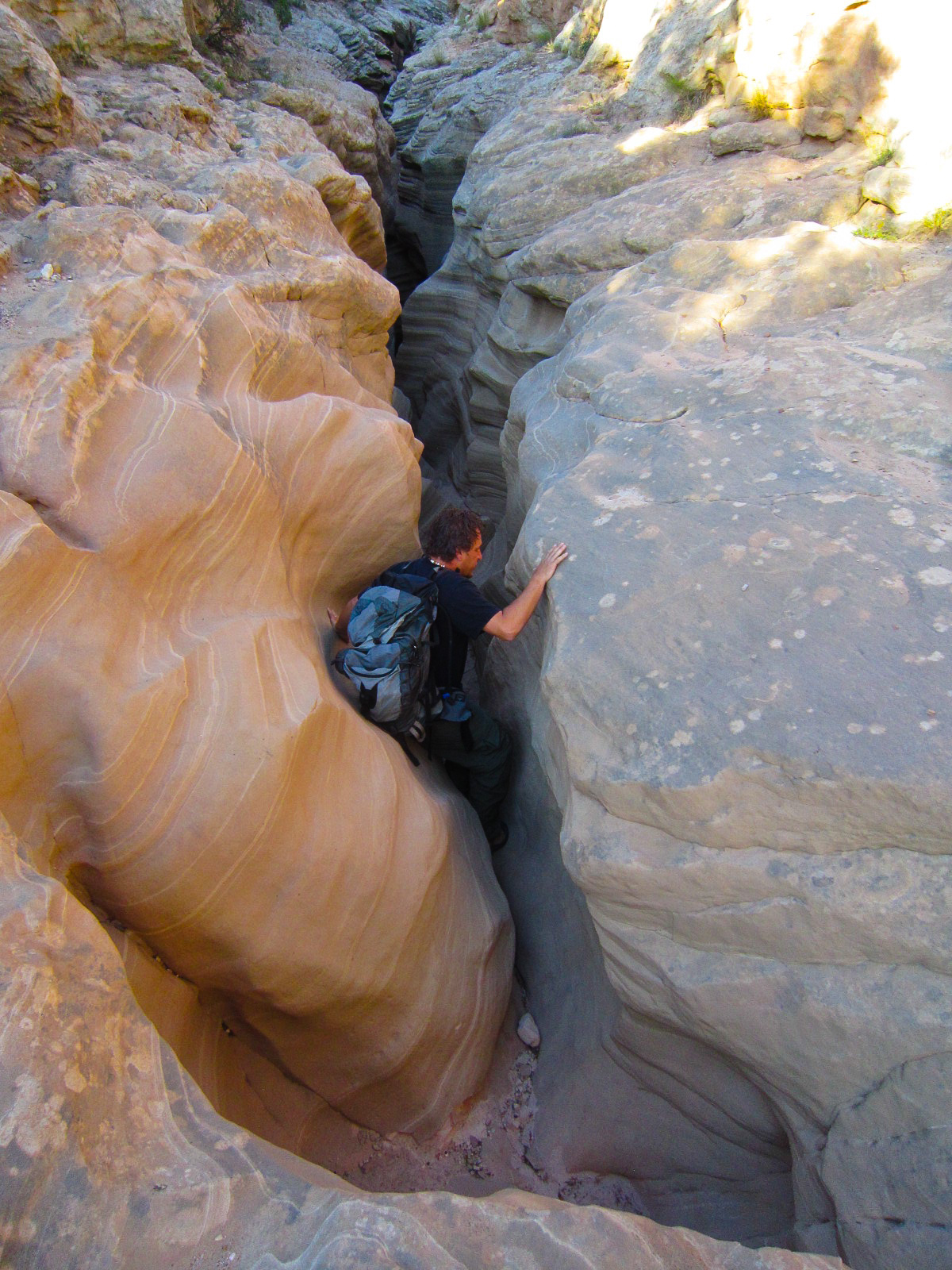
What an adventure! The landscape at the 'right place' looked just like the miles and miles we'd passed to reach a nondescript wash. Three-quarters of a mile down the wash was the entrance, a narrow slit in the ground which required stemming and butt-sliding to descend. Once inside, we found a wonderland of colorful rock--striated, swirled, crenelated, eroded and carved into fantastical walls. Thad is a conscientious and competent guide, giving suggestions for tackling difficult sections and providing a helping hand when necessary. This definitely was the 'cherry on top' of our amazing Utah summer.
 |
| Entering Round Valley Draw |
 |
| Thad directs Fred on descending the 16' drop from entry to floor of the draw  |
 |
| Incredible rock walls! |
 |
| Droppinjg deeper inside Round Valley Draw |
 |
| Deep inside the canyon |

 |
| Thad and Noah |
 |
| Hiking up-canyon back to our entry point |
No comments:
Post a Comment