We were thrilled to have June 15th and 16th as our days off this week because Thursday is our 9th wedding anniversary. To maximize our play time, we left half an hour after finishing work on Tuesday afternoon.
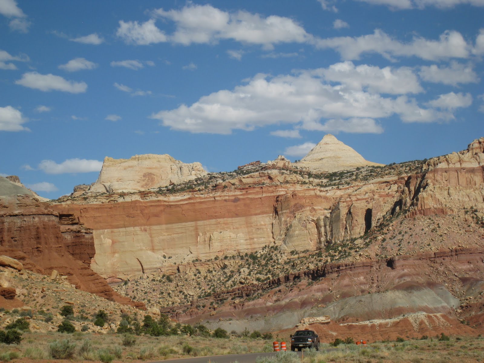
We headed northeast on Utah 12, which more than lives up to its designation of ‘scenic highway’. Our route took us from an arid desert environment to lush alpine meadows—some harboring pockets of snow! This week’s destination was Capitol Reef National Park. We felt that while Capitol Reef isn’t as visually stunning as Zion, it has a greater variety of terrain and coloration than Bryce. There is an interesting historic dimension to Capitol Reef that isn't apparent in the other two Utah parks we’ve visited. We drove the park’s Scenic Drive and the Grand Wash road, stopping frequently for photos, took a short hike and viewed the petroglyph panels. By that time, we were tired and hungry and took the easiest option of eating at the motel’s restaurant. The food was good but ridiculously over-priced and the service was competent but slow.
![]() |
| View from Route 24 Inside Capitol Reef National Park |
![]() |
| Petroglyphs |
On Wednesday we started up the trail to Navajo Knobs at 8 AM. We knew this would be a challenging hike—10 miles over bare rock with no shade and 5800’ of elevation change—so covering as much distance as possible before the heat of the day was worth getting up early. Our effort was rewarded with spectacular views, achy knees and a sense of accomplishment. Being on the summit wasn't as thrilling as I'd imagined. It was difficult to enjoy the summit's almost-360* panorma while perched on a narrow pile of unstable rock with steep drop-offs in every direction and swarms of gnats flying into noses and ears.
![]() |
| Jan Relaxing on Hike Up to Navajo Knobs |
![]() |
| Jan Not Enjoying the Summit of Navajo Knobs |
Before leaving the park, we visited historic Fruita. In the 1890s, Mormon leader Brigham Young ordered one family to this difficult environment to establish an LDS presence in the area. The community gradually grew, attaining its highest population (108) in the 1920s. The residents found their valley, blessed with the Fremont River for irrigation and protected by sandstone cliffs, was ideal for producing fruit. Eventually the valley floor was filled with orchards of apple, cherry, apricot, cherry, nectarine, peach, pear, plum, almond and pecan trees. The Park Service has preserved many of the orchards, a tiny farmhouse typical of the settlement built in 1908 and occupied until 1969, several outbuildings, the picnic area and the one-room schoolhouse.
![]() |
| View of Fruita Farm from Rim Overlook |
Our original itinerary included an anniversary dinner at the Hell's Backbone Grill Wednesday evening and hiking Upper Muley Twist Canyon on Thursday. The effort expended on Navajo Knobs caught up with us on returning to the motel and we modified those plans: breakfast at Hell's Backbone, a visit to Anazasi State Park and a hike to Upper Calf Creek Falls.
Thursday was just a perfect day. The meal at Hell's Backbone was delicious (Fred--blue corn pancakes; Jan--scrambled eggs, potato cake and homemade toast)
![]() |
| Jan at Hells Backbone Grill |
and the setting delightful; the state park, more a museum and archeological excavation site, was well-done, uncrowded and very interesting; and the 2.8 mile hike with lots of elevation change was just enough exercise for the day.
![]() |
| Fred Inside Anasazi Dwelling |
Al-though Lower Calf Creek Falls is higher and more photogenic, the alcove around the pool of the Upper Falls is surrounded by yellow monkeyflower, woods rose, spiderwort and, best of all, scores of lovely stream orchids!
![]() |
| Trail Leading Down to Upper Calf Creek Falls |
![]() |
| Upper Calf Creek Falls |
![]() |
| Stream Orchid at Bottom of Falls |
![]() |
| Alcove at Bottom of Falls |
![]() |
| Obligatory Tree Picture |
We truly had a happy anniversary and a great mini-vacation.